
Use GIS for Real-World Business Insights
A web-based GIS platform that turns complex geospatial data into actionable insights for territory management, logistics, and urban mobility.
What they needed
Businesses increasingly rely on location data to make decisions about sales territories, logistics, asset placement, and urban mobility—but traditional GIS tools can be complex, fragmented, and hard to operationalise. Metis needed a platform that could efficiently transform raw geospatial data into clear, actionable insights while remaining intuitive for non-technical users. The challenge was to build a system that could integrate different data sources, support real-time decision-making, and scale across industries and use cases without overwhelming users with technical complexity.
What we delivered
We worked with Metis to design and develop a web-based GIS platform focused on real business outcomes rather than just map visualisation. The platform centralises geospatial data and exposes it through intuitive dashboards, interactive maps, and configurable views that speak the language of sales, operations, and planning teams. By combining a modern web stack with robust data integration, Metis helps organisations quickly understand where to focus resources, how to optimise routes and territories, and how location dynamics affect performance.
Key Results
See Metis in Action
Explore how Metis turns raw geospatial information into location intelligence that supports day-to-day decisions for sales, operations, and planning teams.
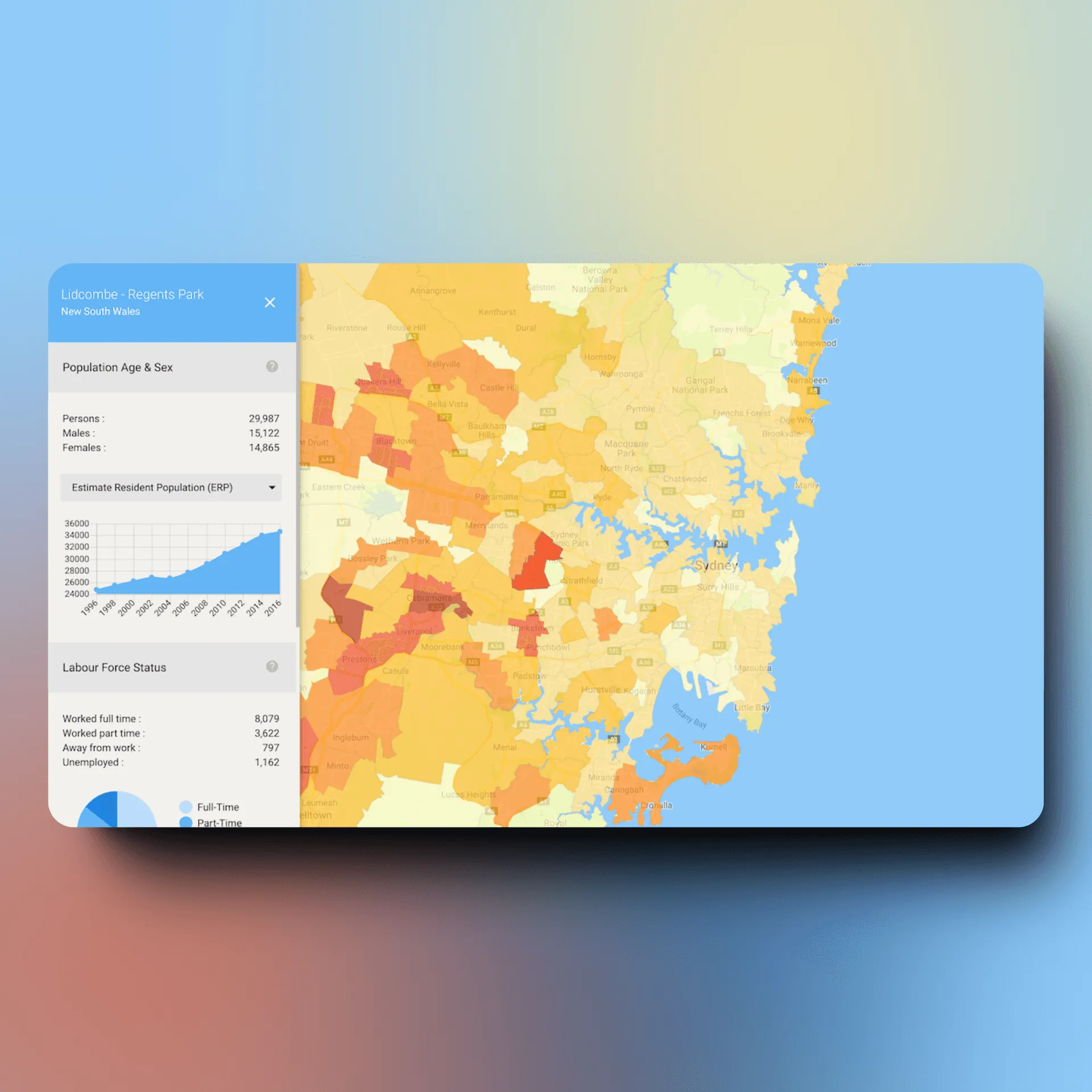
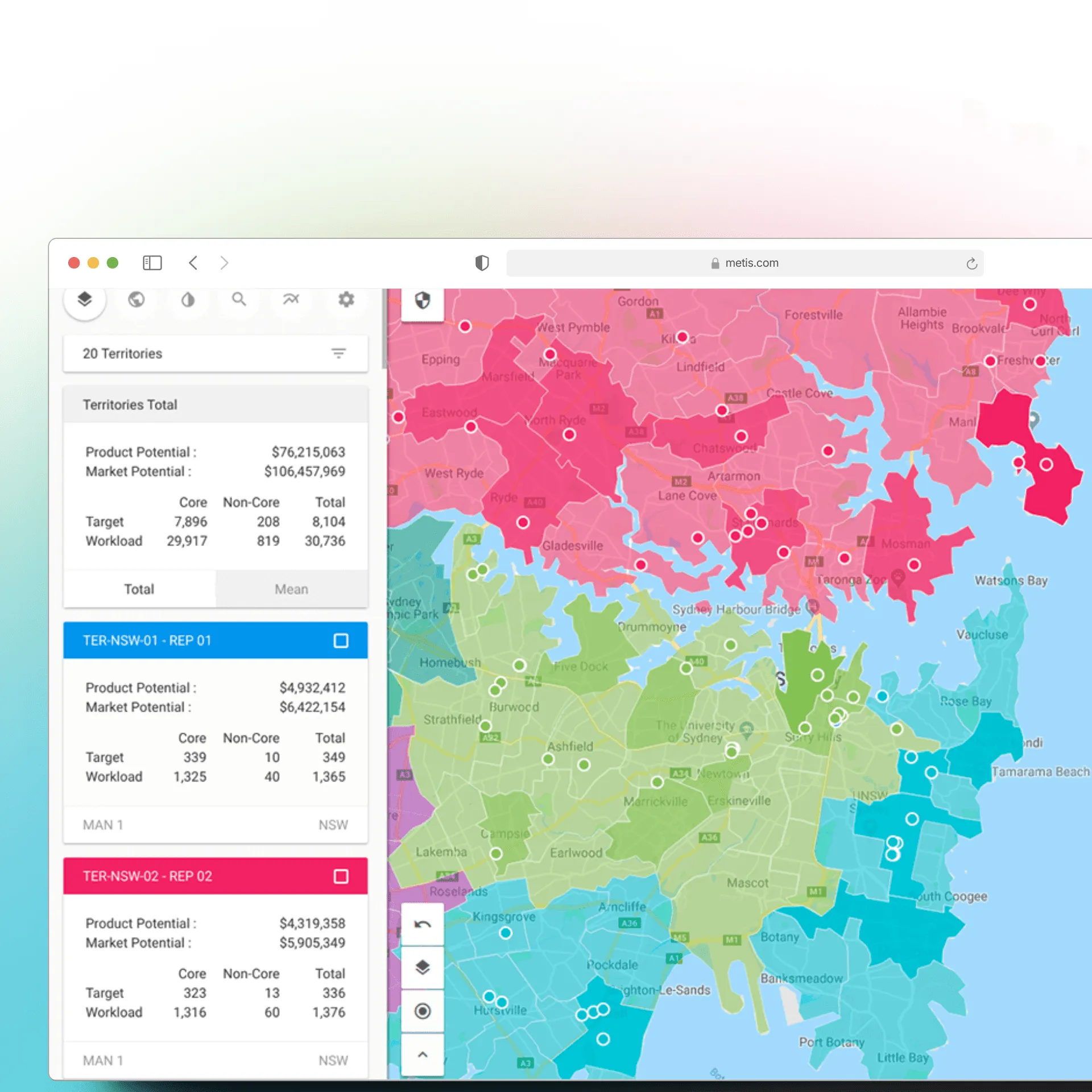
Geospatial Dashboards for Territory & Performance
Interactive dashboards combine maps with KPIs, helping teams monitor territory coverage, performance by region, and hotspots that require attention. Users can drill down from national views to street-level insights in a few clicks.
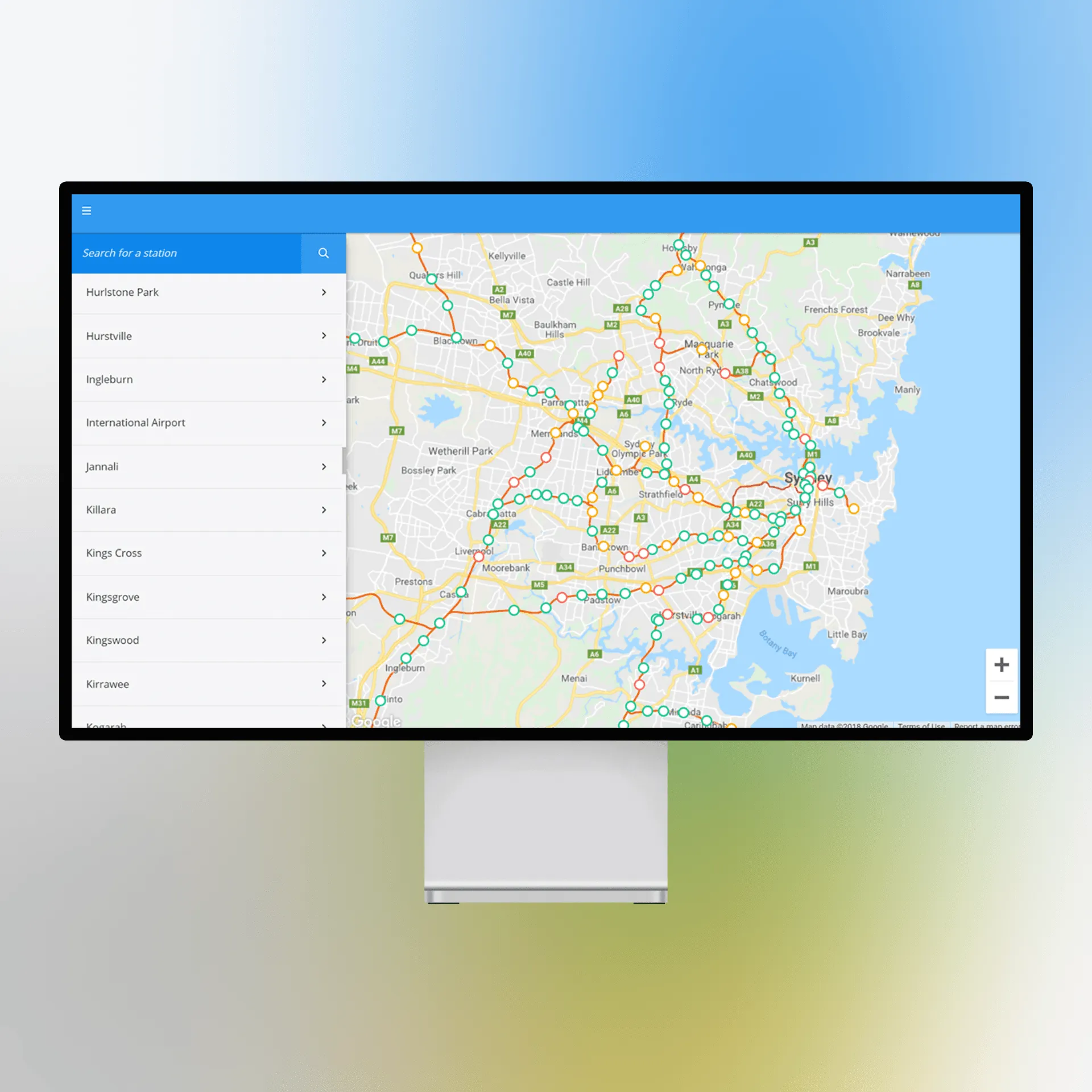
Operational Views for Logistics & Mobility
Operational teams can visualise routes, assets, and urban mobility patterns in real time, using geospatial layers to spot bottlenecks, reroute resources, and plan future network changes based on data rather than intuition.
How we got there
Our approach combined user-centred product design with scalable GIS architecture. We began by mapping the workflows of Metis’ target users—sales leaders, operations managers, and planners—to define the most important questions the platform needed to answer. From there, we designed a UX/UI that makes complex geospatial data easy to explore through filters, layers, and context-rich views. On the technical side, we implemented a modular integration layer so the platform can ingest and combine multiple geospatial and business data sources. Throughout the build, we focused on performance, responsiveness, and a flexible component library so new use cases—like urban planning, asset tracking, or mobility analysis—could be added without rethinking the core product.
Technologies Used
Explore More Case Studies
View All Case Studies
Ready to start your project?
Let's talk custom software and build something remarkable together.